Feature
Survey adjustment
Least squares, data collector files.
Use this add-on:
Overview
Survey adjustment takes the measurements of a survey network (distances, directions, angles, azimuths, GNSS vectors and levelling height differences) and finds the most probable coordinates by least squares. It shows the residuals and the statistical tests that point to a bad measurement. It also reads field files from data collectors, and checks a traverse for closure. It is opened from Surface, More, Survey adjustment in CivilCraft.
Who it’s for
- Surveyors who want an adjustment of a network to check their own work before the field is closed.
- Survey technicians who need a check of traverses and of data collector files.
- Civil engineers who receive survey data and need to see how well the points are held.
What you can do
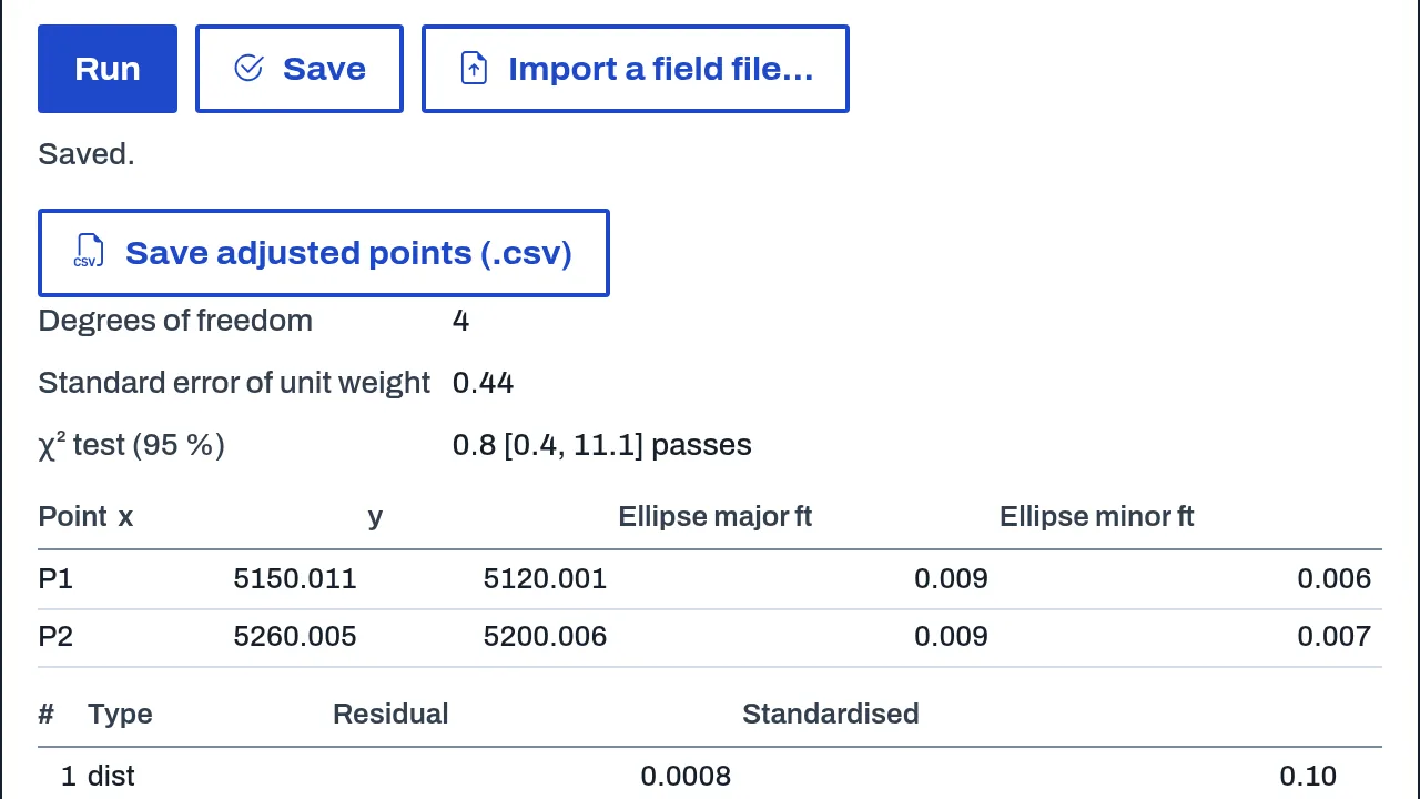
- Adjust a network of fixed and free points with the measurements between them (Survey adjustment, Nets). The result gives adjusted coordinates, residuals, standardised residuals, redundancy numbers, the a posteriori variance factor with its chi-squared test, and 95 % error ellipses.
- Read a data collector file (.rw5, .gsi, .xml, .jxl, .csv or .txt) into setups and shots, reduce it to coordinates and adjust it. A bad line is reported, not guessed.
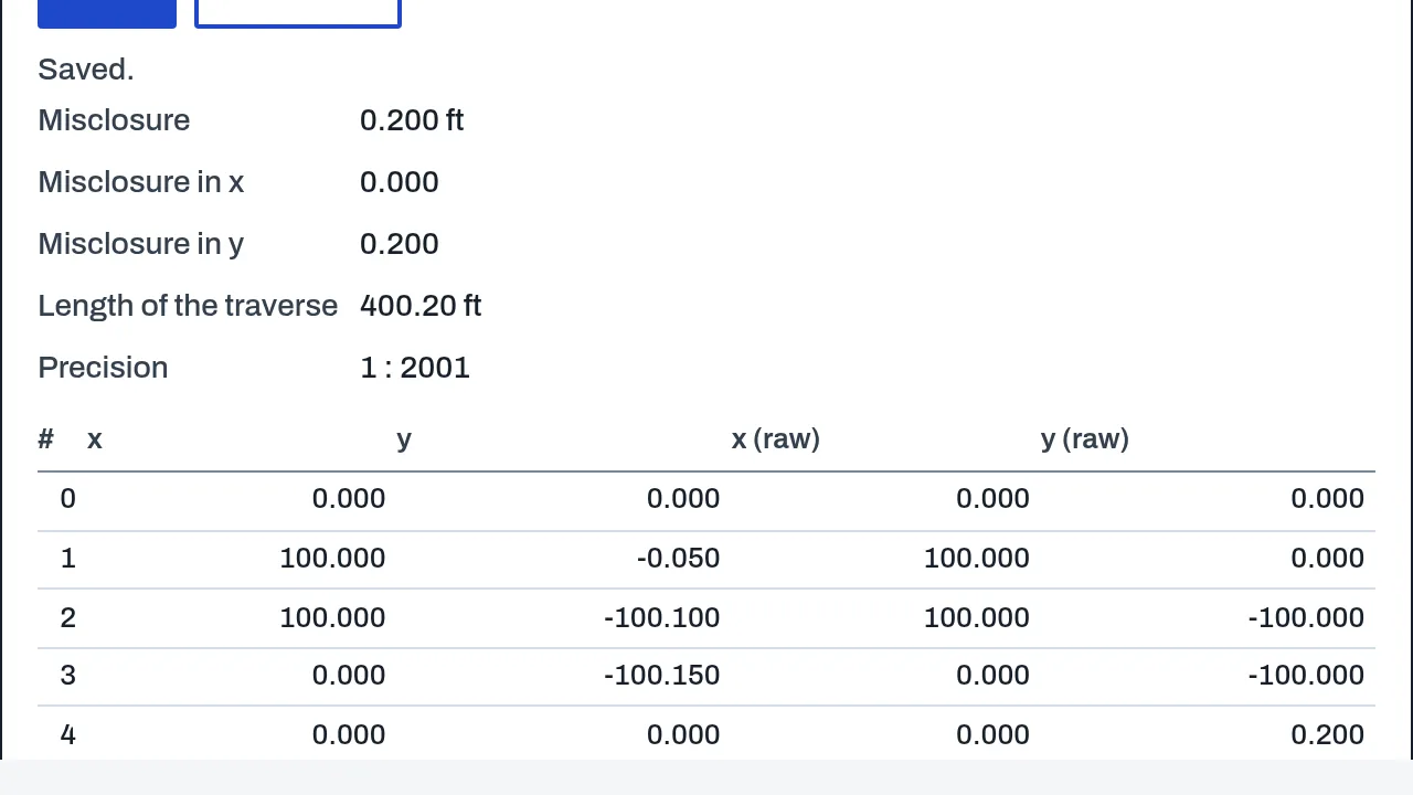
- Check a traverse from angles or bearings and distances: its closure and the compass (Bowditch) adjustment (Survey adjustment, Traverses).
- Save the adjusted coordinates as a CSV file.
Methods and standards
Parametric least squares by Gauss-Newton, weighted by the standard deviation of each observation, following Ghilani and Wolf, Adjustment Computations, 6th edition, chapters 11 to 16. Blunders are tested with Baarda's data snooping (the w-test, critical value 3.29 at alpha 0.001). The variance factor is tested with chi-squared. Traverses are checked by closure and adjusted by the compass rule. Collector files are reduced by polar reduction from each setup's station and backsight.
Data and sources
There is no reference data in this add-on. You supply the measurements, the control points and the standard deviation of each observation, either typed in or read from a field file.
Verification
Tested by bin/test-civilcraft-adjust.mjs, with known answers: a height seen twice, a levelling loop, a point from four distances checked against an independent minimiser, a planted blunder that is flagged, and a noisy network that passes the chi-squared test. Also tested by bin/test-civilcraft-collector.mjs and bin/test-civilcraft-traverse.mjs. The collector readers were tested on files written from the formats' public descriptions; no real instrument file has been read yet. Not yet checked against a surveyor's reference network.
Limits
A calculation aid: a surveyor checks any adjustment that matters. The readers say what they did not understand instead of guessing, so expect to check the import of a new file. Plats, COGO and deed work are not in this add-on.
Files and formats
Reads raw data collector files: Carlson or SurvCE RW5, Leica GSI-8 and GSI-16, Trimble JobXML, and a plain CSV (station, backsight, target, horizontal angle, vertical angle, slope distance, target height, code). Writes the adjusted coordinates as CSV. Networks and traverses are saved with the project's geo items.
Get started
- Open CivilCraft, then Surface, More, Survey adjustment.
- Add the points (fixed or free) and the measurements between them, or read a data collector file.
- Run the adjustment, check the residuals and the variance test, then save the adjusted coordinates as CSV.
Languages
No languages are listed for this add-on yet. Its maker may add some.
Works in
| Edition | Works | Note |
|---|---|---|
| Browser (/use) (yours) | Added on demand | Fetched the first time you use it, then kept for offline use. |
| Studio from getcadcraft.com | Added on demand | Fetched the first time you use it, then kept for offline use. |
| Microsoft Store | Added on demand | Fetched the first time you use it, then kept for offline use. |
| Google Play | Added on demand | Fetched the first time you use it, then kept for offline use. |
| iPad and iPhone (App Store) | Included; switch it on | Part of the reviewed app; your list switches it on. |
| Custom build | Added on demand | Fetched the first time you use it, then kept for offline use. |
Comes with
Nothing else.
Needed by: Autonomous systems and drones, Civil and site engineering, Mining engineering, Rail engineering, Surveying and geomatics, Telecommunications and fiber networks, Transportation and traffic engineering, Tunnel and underground engineering.
Versions
| Version | Channel | Date | What changed |
|---|---|---|---|
| 1.0.0 | stable | October 28, 2026 | First version in the Library. |
Licence and maker
CadCraft (CadCraft, first-party). Licence: Apache-2.0. Dependencies carry their own licences, listed on their pages.